


Elim Precinct, Custer County, Nebraska
About
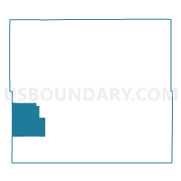
Outline

Summary
| Unique Area Identifier | 612627 |
| Name | Elim Precinct |
| County | Custer County |
| State | Nebraska |
| Area (square miles) | 108.64 |
| Land Area (square miles) | 108.64 |
| Water Area (square miles) | 0.00 |
| % of Land Area | 100.00 |
| % of Water Area | 0.00 |
| Latitude of the Internal Point | 41.25172480 |
| Longtitude of the Internal Point | -100.13891730 |
Maps


Graphs
Select a template below for downloading or customizing gragh for Elim Precinct, Custer County, Nebraska


Neighbors
Neighoring Voting District (by Name) Neighboring Voting District on the Map
- Arnold Precinct, Custer County, NE
- Brady Precinct, Lincoln County, NE
- Delight Precinct, Custer County, NE
- Grant Precinct, Custer County, NE
- Triumph Precinct, Custer County, NE
- Wayne Precinct, Custer County, NE
Top 10 Neighboring County Subdivision (by Population) Neighboring County Subdivision on the Map
- Brady precinct, Lincoln County, NE (1,094)
- Arnold township, Custer County, NE (759)
- Delight township, Custer County, NE (698)
- Wayne township, Custer County, NE (140)
- Elim township, Custer County, NE (133)
- Triumph township, Custer County, NE (118)
- Grant township, Custer County, NE (61)
Top 10 Neighboring Unified School District (by Population) Neighboring Unified School District on the Map
- Gothenburg Public Schools, NE (4,528)
- Callaway Public Schools, NE (1,294)
- Arnold Public Schools, NE (1,021)
- Brady Public Schools, NE (913)